
PROJECT UPDATE
Activity Update on the EU support to NPAA for the Management of the High Value Conservation Area of the Loma Mountain National Park
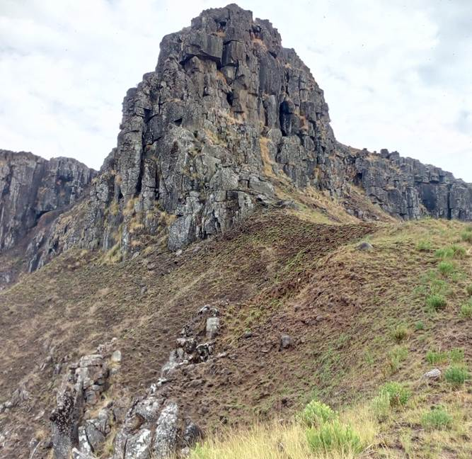
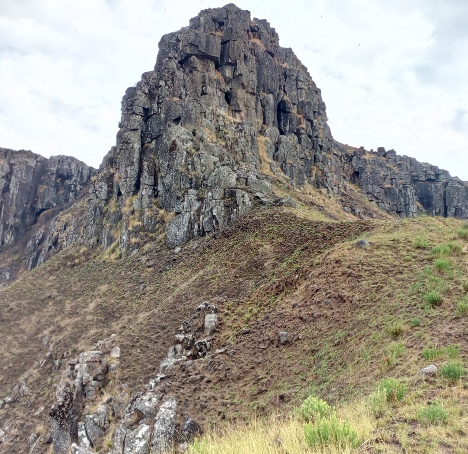
THE LOMA MOUNTAIN MASSIF – 1945m asl
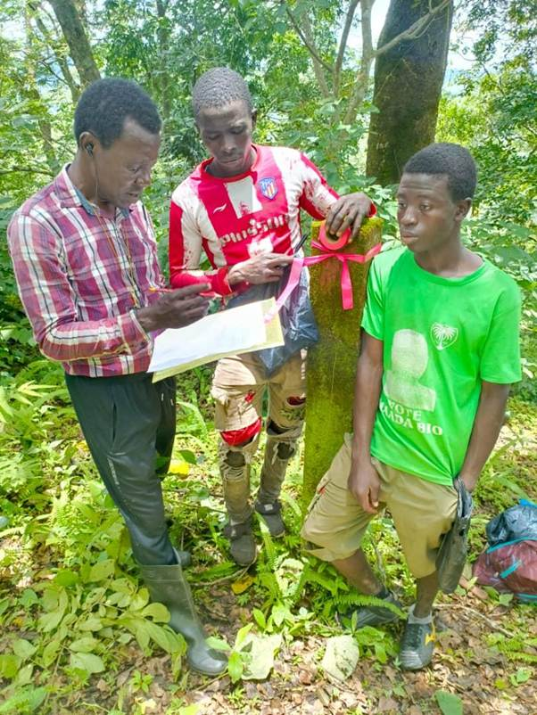
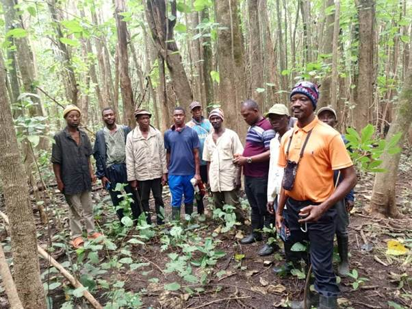
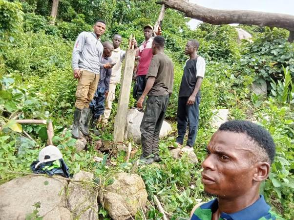
Boundary Retracing of the Loma Mountain National Park by the GIS Team
The boundary identification and demarcation activity for the Loma Mountains National Park (LMNP) was carried out through a joint field mission involving NPAA GIS technical staff, chiefdom authorities, and community representatives. The objective of the exercise was to accurately delineate the park’s legal boundaries, define associated buffer zones, and identify high-value biodiversity areas within the broader landscape. Over several days, the mixed team traversed the park perimeter, using GPS devices, legal boundary descriptions, and local knowledge to verify, map, and materialize the official limits of
LMNP.
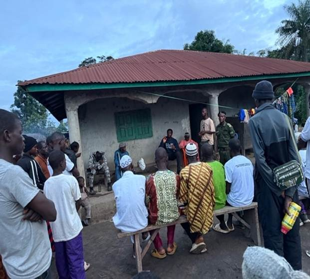
Throughout the mission, participatory meetings were held with communities in the forest-edge communities to validate boundary lines and resolve long-standing ambiguities. These meetings enabled open dialogue on contested areas, allowed the incorporation of customary land information, and ensured that all demarcation decisions reflected both statutory requirements and community realities. Through this collaborative approach, critical boundary points were identified and marked, providing greater clarity on where the park begins and ends. The process also facilitated the mapping of buffer zones that accommodate community use while safeguarding sensitive ecological areas.
As the team moved through the landscape, major biodiversity hotspots were documented, including wildlife corridors, high-canopy forest patches, and water catchments that are crucial to the ecological integrity of LMNP. This information strengthens the basis for improved conservation planning and targeted protection measures. Despite challenges such as difficult terrain, intermittent GPS signal disruptions, and the need for extended discussions in disputed sections, the team successfully completed a comprehensive and widely accepted delineation of the park.
The activity resulted in a unified, georeferenced boundary dataset and strengthened cooperation between NPAA and the chiefdom authorities. It also enhanced community understanding of the significance of boundary demarcation for reducing conflict, protecting resources, and long-term biodiversity conservation. Overall, the exercise achieved its intended outcome by producing a clearly defined, jointly validated boundary for LMNP, laying the groundwork for improved protected area management and future monitoring efforts.
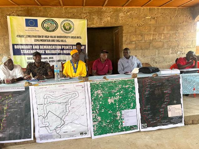
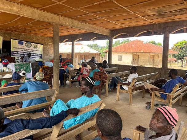
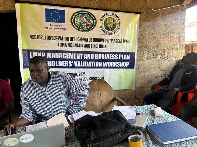
LMNP Management and Business plan including regulations and standard procedures, is revised and updated.
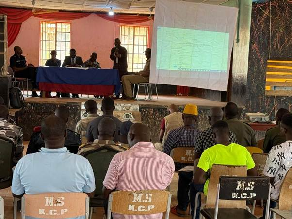
The revision and updating of the LMNP Management and Business Plan were completed through a highly participatory and collaborative validation workshop involving NPAA officials, chiefdom authorities, community stakeholders, conservation partners, and the technical expert. The workshop provided a structured platform to review the draft plan, ensuring that all regulatory provisions, management strategies, and standard operating procedures aligned with current realities in the LMNP landscape.
During the session, participants examined each component of the plan, including governance structures, enforcement mechanisms, revenue management, biodiversity protection strategies, community engagement frameworks, and sustainable livelihood considerations. Feedback was openly discussed, and proposed adjustments were incorporated to enhance clarity, feasibility, and compliance with national conservation policies and legal requirements.
The participatory nature of the workshops contributed significantly to the quality and legitimacy of the updated plan. Representatives from surrounding chiefdoms reaffirmed their roles in supporting management actions, while technical institutions provided inputs on operational standards, monitoring protocols, and financial planning. The process also helped harmonize differing perspectives and strengthened stakeholders’ ownership of the final document.
By the end of the workshops, the Management and Business Plan was fully validated, reflecting a more robust, actionable, and context-sensitive framework for the governance of LMNP. The revised document now offers clear operational guidance, improved regulatory provisions, and standardized procedures to support effective park management, resource protection, and sustainable financing. The successful validation marks a major milestone in strengthening LMNP’s long-term conservation and institutional sustainability.

A monitoring and surveillance system coordinated with KIS for LMNP is established and operative
The establishment of a coordinated monitoring and surveillance system for the Loma Mountains National Park (LMNP), integrated with the KIS platform, has been successfully achieved and is now fully operational. A quarterly joint surveillance patrols were carried out, bringing together NPAA rangers, local community-based monitors, chiefdom representatives, and law enforcement agencies. This collaborative patrol structure has strengthened field-level protection efforts, improved information sharing, and enhanced the overall responsiveness of conservation operations within the park.
During the patrols, teams systematically covered priority zones identified through KIS data, including wildlife corridors, high-threat areas, and sensitive ecological sites. Using standardized reporting tools and GPS-enabled devices, patrol members collected real-time information on illegal activities, wildlife sightings, habitat conditions, and community interactions. Data were collected to enable timely decision-making and targeted enforcement actions.
The participatory nature of the patrols significantly improved trust and coordination between the rangers and surrounding communities. Stakeholders gained a better understanding of the importance of surveillance, while law enforcement institutions contributed to strengthening deterrence and ensuring compliance with conservation regulations. The joint approach also created opportunities for capacity building, as community monitors received hands-on training in patrolling techniques, evidence gathering, safety protocols, and the use of digital monitoring tools.
As a result of these efforts, the monitoring and surveillance system is now functioning as an integrated and dependable mechanism for safeguarding the LMNP landscape. It has enhanced detection and reporting of threats, reduced gaps in enforcement coverage, and provided a more accurate picture of ecological and security conditions across the park. The operationalization of this system marks a significant step forward in improving the protection and resilience of LMNP’s biodiversity and natural resources.
Capacity-building training on PA law compliance for law enforcement agents
Capacity-building training on Protected Area (PA) Law compliance is essential for law enforcement agents because it enhances their understanding of both national and international laws that govern these areas.
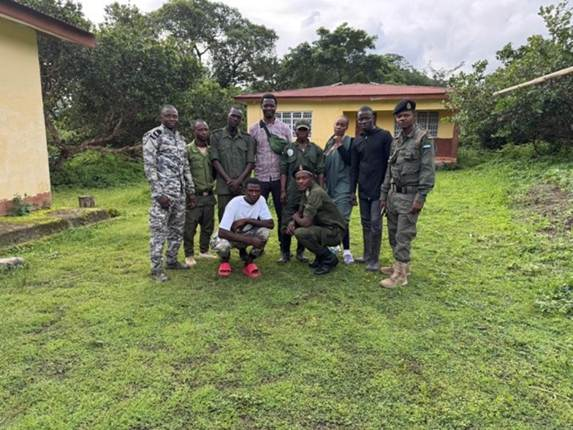
On March 13, 2025, the Law Enforcement Manager of NPAA organised a capacity-building training session for law enforcement agents from the chiefdoms of Nieni, Nyedu, and Barawa-Wollay. This two-day training event took place at the community centre in Kabala Township. A total of 45 participants from various institutions attended the training, including representatives from the Sierra Leone Police, NPAA Rangers, RSLAF, DISEC, Chiefdom Administrative Councils, District Councils, and the ONS security Coordinator. The training aimed to enhance the skills and capabilities of law enforcement personnel.
This knowledge enables them to enforce regulations accurately and fairly. Additionally, the training improves their ability to detect, prevent, and respond to illegal activities such as poaching, illegal logging, and encroachment. By equipping officers with the right skills and information, they can contribute more effectively to biodiversity conservation and the protection of ecosystems and endangered species. The training also promotes better collaboration among various enforcement agencies, communities, and conservation stakeholders, leading to more coordinated and effective enforcement efforts.
Furthermore, it helps to reduce legal gaps and potential abuse of office power by ensuring that officers follow proper procedures, which in turn fosters trust and minimises conflict with local communities. Overall, capacity-building strengthens the efficiency, accountability, and long-term sustainability of law, enforcement in managing and safeguarding protected areas.

Establishment of transects & camera trap deployment for biomonitoring data collection
The conservation of wild flora and fauna is an integral part of the mandate of the National Protected Area Authority. The monitoring of the biological diversity of protected areas with the use of camera traps is an on-the-ground monitoring tool that the Authority hopes to accomplish this activity with.
The Loma Mountain National Park is rich in mammals, birds, reptiles and fish of different types. Several plant species also exist in the are,a with grassland and gallery forests in a continuum and patches. The biological diversity and the entire ecology of the area, like other ecosystems, are subjected to both manmade and natural threats that need scrupulous management intervention if conservation gains are to be realised. The intervention of the National Protected Area Authority is by no means a coincidence but a legal mandate bestowed upon the Authority to salvage the situation, not only in the intended intervention areas but in every part of the country.
The establishment of transects & inventory plots at LMNP for periodic information gathering on the abundance of species, the level of threats, and the diversity of species over a set period is a strategy intended to compare these monitoring parameters over time and make a conclusion on the health of the PA in terms of biodiversity loss or gain.
Trapping is to determine the presence, diversity, abundance, diversity and distribution of species within the LMNP.
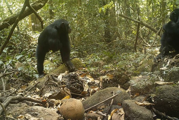
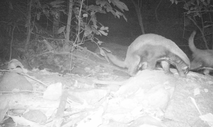
Western Chimpanzee (Pan troglodytes verus).
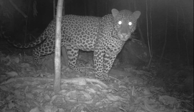
Leopard
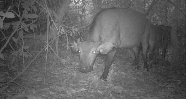
African Buffalo ( Syncerus caffer)
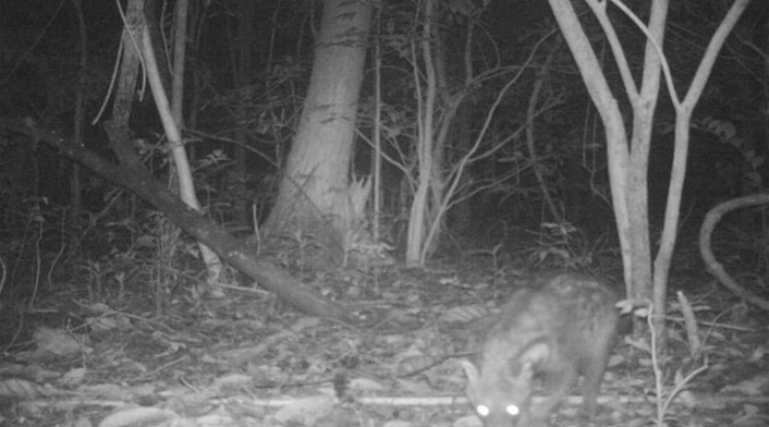
Common genet.
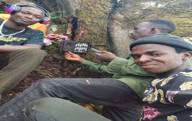
Camera trap deployment
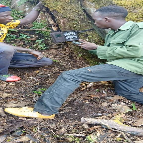
Deployment of camera trap
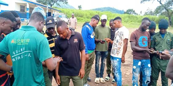
Training on the use of SMART phones for bio-physical data collection.